Aboriginal presence in the Wacol area—historically known as Woogaroo – extends back thousands of years and forms part of the traditional lands of the Jagera and Turrbal peoples. Archaeological and oral evidence indicates sustained occupation, with the Woogaroo clan utilising the area’s river systems, creeks, and natural resources for camping, food gathering, and ceremonial purposes. Artefact concentrations, including stone tools and flaked glass, have been identified across the Wacol landscape, demonstrating both pre-contact activity and continuity into the historic period .
The area contained important cultural sites, including bora grounds (initiation and ceremonial earth circles), campsites, and meeting places linked to water sources such as Woogaroo Creek and the Brisbane River. These sites formed part of a broader cultural landscape that included pathways, fighting grounds, and significant natural features. Historical accounts from the 1840s, particularly those of Dr Stephen Simpson, confirm regular Aboriginal presence in the district, with local people engaged as trackers, labourers, and intermediaries, while maintaining traditional movement and social structures .
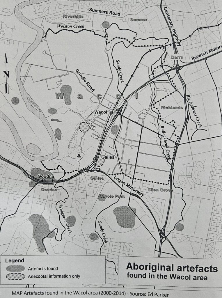
Long before the establishment of Camp Columbia during the Second World War, Aboriginal people lived in and moved through the Wacol–Goodna area as part of this wider cultural landscape. Archaeological work has identified several Aboriginal camps within what is now Wacol, including sites opposite the present railway station and at the location of the Queensland Correctional Services Academy. While much of this landscape was later altered by wartime construction and post-war redevelopment, these findings reinforce the extent and persistence of Aboriginal occupation.
Research by historian Dr.Ray Kerkhove, in Aboriginal Campsites of Greater Brisbane, documents traditional camps across the Brisbane region, including in the Goodna area. Subsequent archaeological work has identified additional sites, further demonstrating that the Camp Columbia area formed part of a dense and interconnected Aboriginal landscape rather than an isolated location.
Evidence also suggests the existence of semi-permanent or “fringe” camps during early colonial settlement. However, more recent archaeological interpretations indicate that these were often continuations of long-standing traditional occupation patterns rather than new formations. Ceremonial sites such as those at Gailes and along Sandy Creek highlight the cultural and spiritual significance of the area, even where physical evidence has been diminished by later development.
This long history of Aboriginal connection to place extends into the twentieth century. Following World War II, parts of the former Camp Columbia military facilities at Wacol were repurposed for civilian use, including Aboriginal housing. Known as the Wacol Housing Camp, this post-war settlement represents a further layer in the site’s history, linking the wartime landscape with ongoing Aboriginal presence and adaptation in a changing social and political environment.
The name Woogaroo—later replaced by Goodna for part of the district—reflects the deep Aboriginal linguistic and cultural imprint on the region. Despite the impacts of colonisation, displacement, and land use change, the Wacol/Woogaroo landscape retains important evidence of enduring Aboriginal connection and cultural continuity.
Source and permissions
This abstract is based primarily on:
Vicki Mynott, Wacol, Wolston, Woogaroo 1823–2014, Volume 1, published by the Richlands, Inala and Suburbs History Group.
Additional contextual material is drawn from:
Dr Ray Kerkhove, Aboriginal Campsites of Greater Brisbane.
The material from Mynott’s publication is used with permission from the author.