In May 1942, amidst the backdrop of World War II, the Gailes Emergency Landing Ground (ELG) was constructed for the American military. The Royal Australian Air Force (RAAF) subsequently assumed control of the site, categorizing it as a B-1 type airfield, characterised by a single runway exceeding 800 yards. Intended primarily as a crash strip, the Gailes ELG was strategically important, albeit short-lived in its operational capacity.
It was build in between Archerfield Airport and Amberly Airport, within the broader military Wacol area that was managed from Camp Columbia. If planes had trouble after taken off they could land here rather than flying back top one of the other two very busy airports. As far as it is known the airstrip was never used.
Initial Development and Usage
The arrival of U.S. forces in Queensland from late December 1941 precipitated a pressing need for additional airfields to accommodate their aircraft. While existing RAAF airfields were utilised, new sites were also developed. Gailes, alternatively known as Wacol or A-9, was among these new constructions. The site featured a single airstrip built in 1942, with the Brisbane construction company Hornibrook contracted to erect a hangar and execute camouflage work by May of that year. The “hangar” likely comprised arched timber truss hideouts, as suggested by RAAF documentation from 1943, which mentioned several unserviceable hideouts at Gailes.
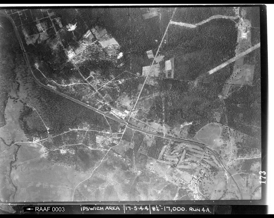
Physical Layout and Abandonment
Geographically, the northwest end of the airstrip was located in what is now just north of Tile Street, east of Boundary Road. The southeast end stretched between Doreen Crescent and Sinclair Drive, north of Southampton Road. Trees were cleared beyond each end of the strip to facilitate aircraft approach. However, the site proved suboptimal and was soon categorised as a Relief Landing Ground (RLG) and Crash Strip by the RAAF.
In August 1943, a RAAF inspection reported a cleared but unserviceable strip due to regrowth of plant suckers, log barricades, and a “mine crater.” The airstrip, aligned at 145 degrees and measuring 5200 feet by 250 feet, featured an undulating surface and was accessible only via a poor bush track from Ipswich-Brisbane Road. Despite removing plant suckers in September 1943, a significant hole in the center of the strip was noted by May 1944, further contributing to its decline.
Subsequent Developments and Legacy
By April 1944, a U.S. report indicated that the Gailes project had been abandoned after preliminary work, leaving the area overgrown and unusable. Post-war, the suburb of Carole Park was developed over the former airstrip, erasing any physical remnants of the site.
Historical Context and Naming
The Gailes ELG takes its name from the railway station established in 1925, named after the Western Gailes Golf Course in Scotland. The area, previously known as Dingo Hill, was renamed Gailes at the suggestion of Dr. H. Byram Ellerton’s wife. Dr. Ellerton was the superintendent of the Goodna Hospital and a founding member of the Goodna Golf Club, which later became the Gailes Golf Course in 1935. The name Gailes was noted to mean “overgrown with bog-myrtle” by the London County Council librarian in 1978.
.Below is a video from Cam Carter Adventures,
See also: