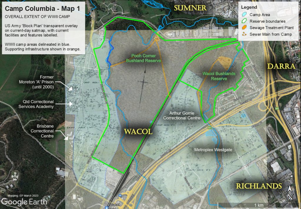
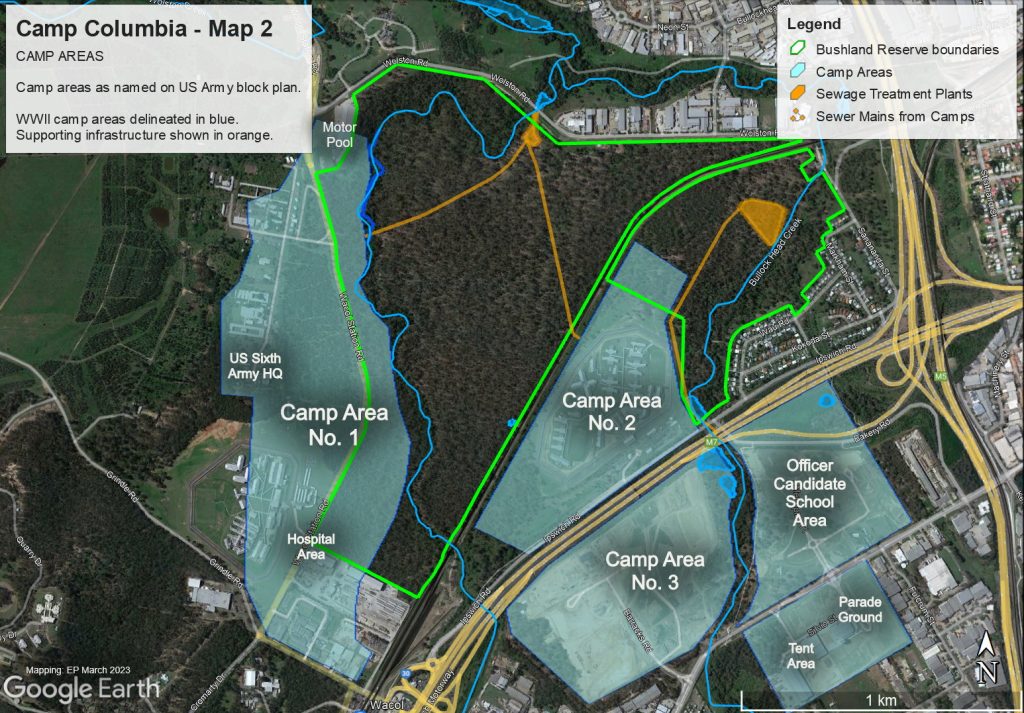
These three maps show the Camp Columbia (CC) area as it currently is used. The maps are overlayed on the original WWII map that shows the military buildings and infrastructure of the WWII Camp. There are still some areas that have not been overbuilt and it clearly show that these area will still hold remanent of the Camp and most likely artefacts as they have been found elsewhere in the area.
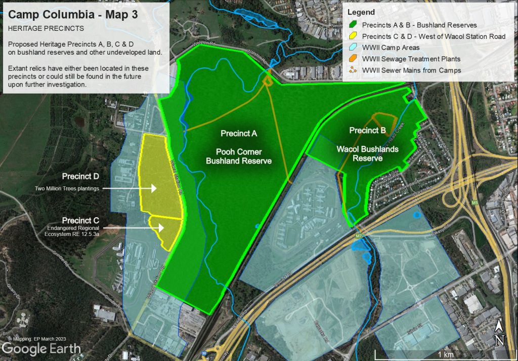
Below are the proposed ‘Heritage Precincts for the nomination.
The precincts are (going clockwise from Pooh Corner, which is the core area and key area for heritage listing):
- A – Pooh Corner Bushland Reserve
- B – Wacol Bushlands Reserve
- C – Endangered RE 12.5.3a
- D – Two Million Trees planting site
Precincts C and D are in the ownership of Qld Corrective Services (QCS) but are undeveloped, while A and B are owned by Brisbane City Council.
More maps and aerial photographs of Camp Columbia
Remnants of Camp Columbia at Pooh Corner Reserve